Extreme Wet Weather Brought About By Two Typhoons
On 29 July, Kyrios was informed about the extreme floods in Fujian province caused by Typhoon Doksuri. Typhoon Doksuri had made landfall just a day earlier on 28 July and was notable in its strong intensity as it had time to develop and strengthen after forming on 21 July in the seas east of Philippines. Typhoon Doksuri brought with it heavy rains and strong winds which rapidly inundated Fujian province and the surrounding regions. To reduce precipitation in the area, Kyrios took action to disperse and move rain clouds towards the sea.
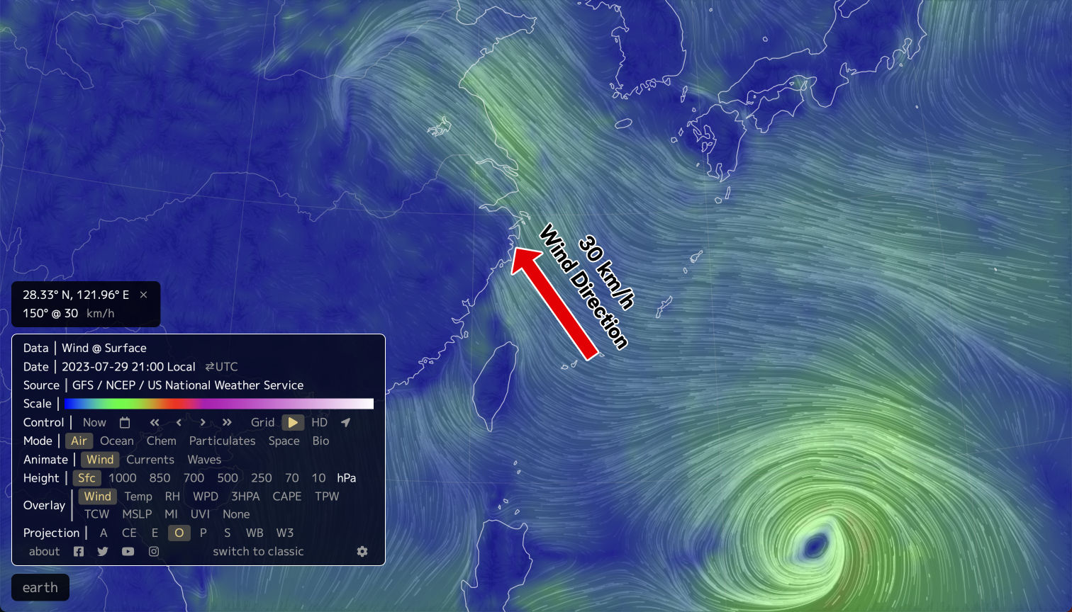
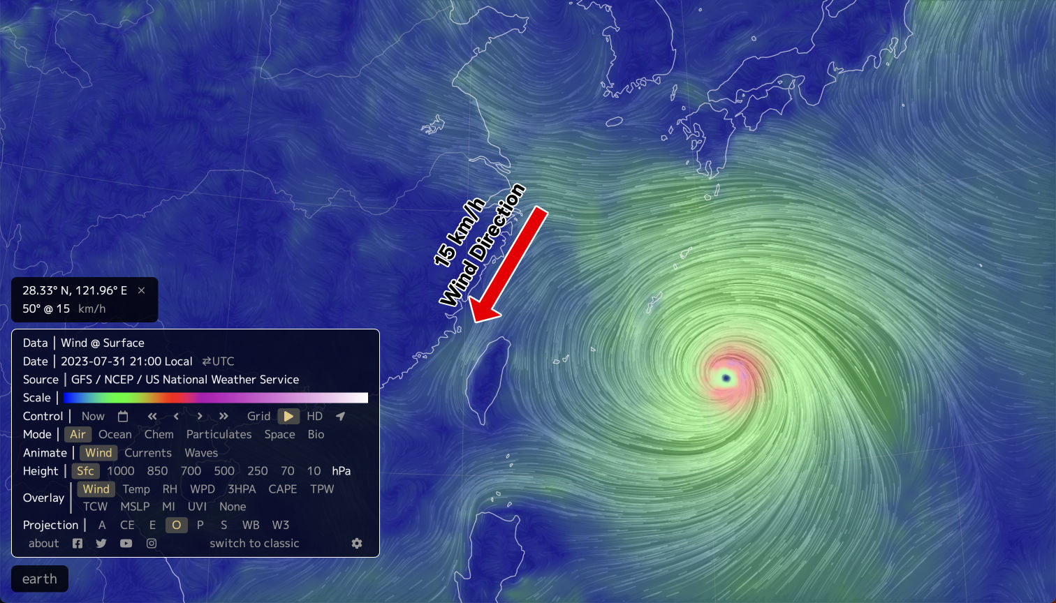
On 30 July, Kyrios once again modified the weather system to disperse the rain clouds. This led to a noticeable change in wind speed and direction off the coast of Zhejiang province (see Figure 1).
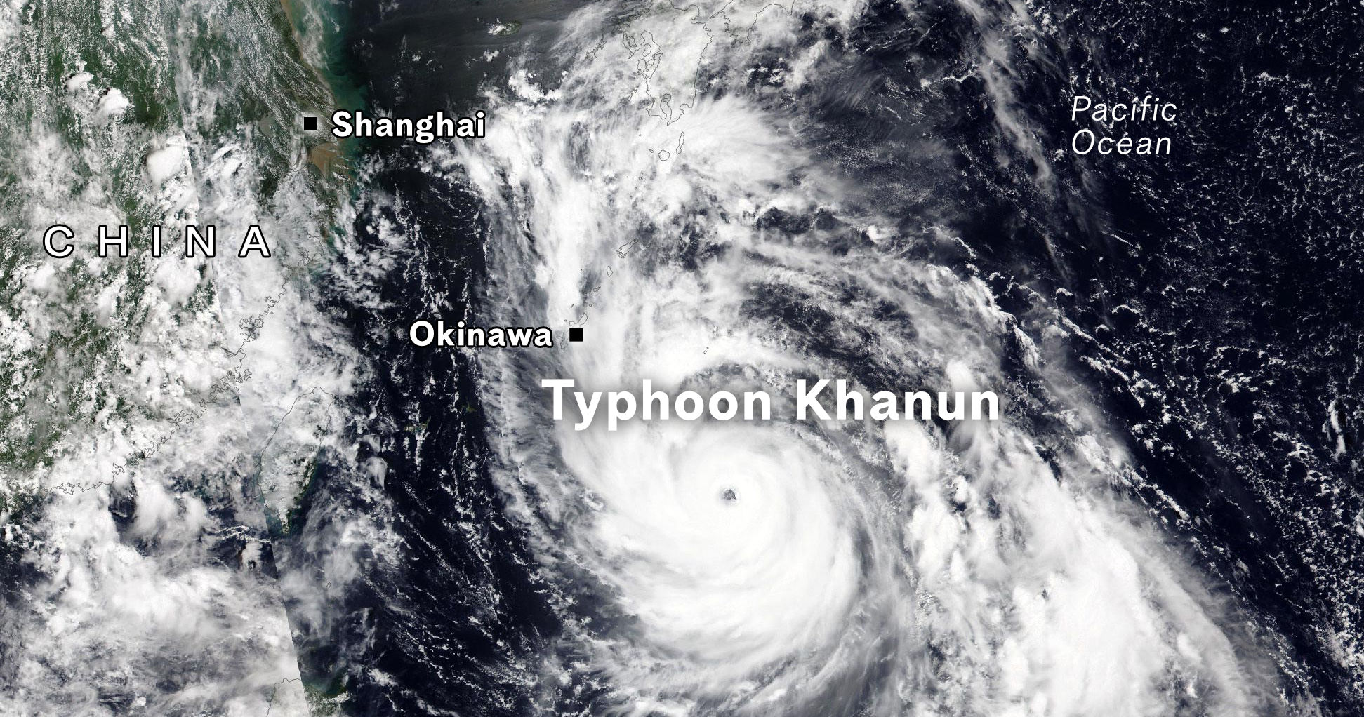
Typhoon Khanun’s sudden change in direction away from China mainland
Around the same time, another Typhoon named Khanun was also heading towards Chinese mainland in the direction of Zhejiang province (see Figure 2). Typhoon Khanun was originally forecasted to make landfall in Zhejiang province on 2 August.
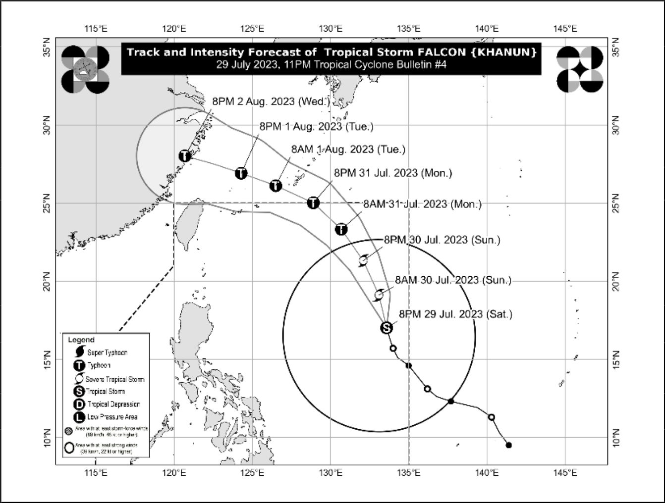 Figure 2: On 29 July 2023, just after Kyrios' intervention started, Typhoon Khanun was forecasted to head towards Zhejiang province. Source: Tropical Cyclone Bulletin No. 4 from Philippine Atmospheric, Geophysical and Astronomical Services Administration (PAGASA)
However, with Kyrios’ ongoing intervention to alter the weather system to reduce precipitation across Mainland China, Typhoon Khanun trajectory dramatically changed. This was reported in Tropical Cyclone Bulletin No. 4, published by PAGASA on 31 July (see Figure 3), where it forecast that Khanun would slow down, stall and then U-turn away from China, instead of following its original path of heading westwards to make landfall.
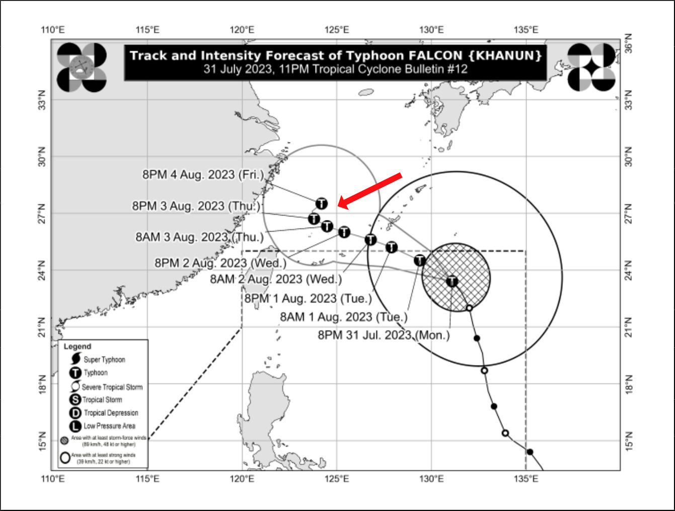 Figure 3: On 31 July 2023, two days after Kyrios began intervention, Typhoon Khanun was forecasted to change direction and move away from the Chinese mainland (as indicated by the red arrow). Source: Tropical Cyclone Bulletin No. 12 from Philippine Atmospheric, Geophysical and Astronomical Services Administration (PAGASA)
On 2 August, as Typhoon Khanun approached close to the shores of Zhejiang province, Kyrios wanted to be sure that Khanun would steer clear of China even though forecasts already predicted that Khanun would turn away (see Figure 4). As such, on 2 August, and again on 3 August, Kyrios focused on steering Khanun away towards the sea.
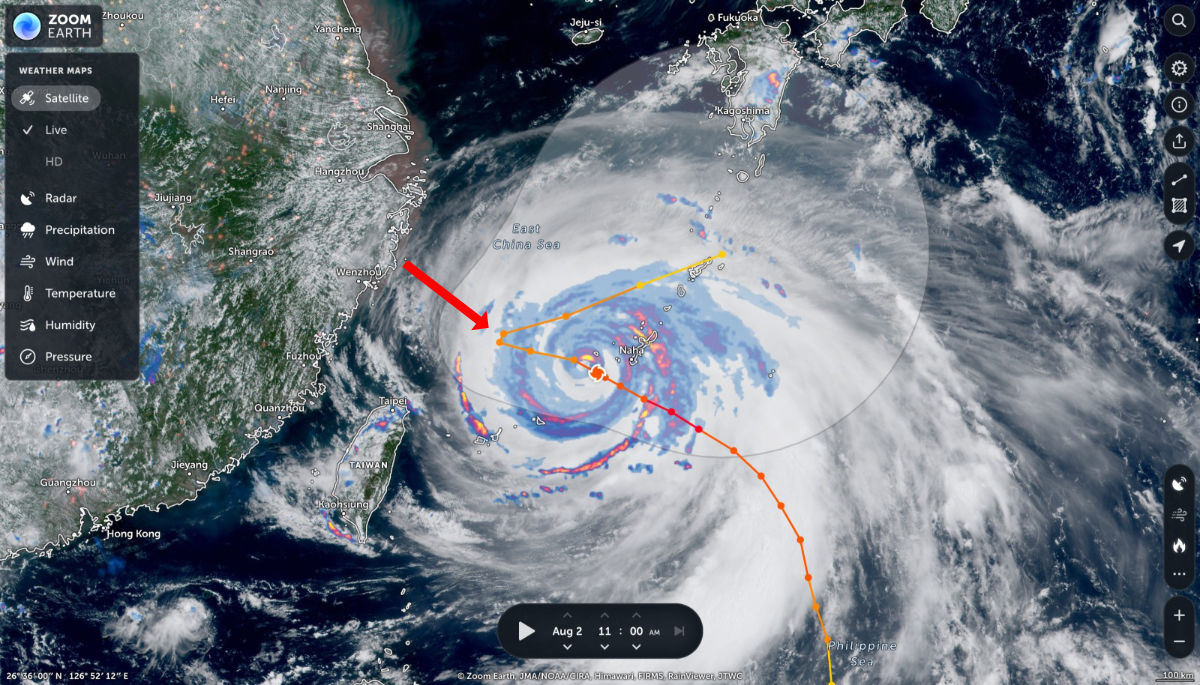 Figure 4: Typhoon Khanun was forecasted to turn east, away from China mainland on 2 August 2023 (indicated with red arrow). Source: Zoom Earth
The Japan Meteorological Agency reported on 3 August that Typhoon Khanun “is expected to slow to nearly stationary movement before a weakening high pressure system nearby allows it to turn east Friday.”
Without Kyrios’ intervention, additional rainfall would have brought further devastation to the local communities and infrastructure, overwhelming the already flooded regions in China, which is still reeling from the effects of Typhoon Doksuri.
Fujian province and eastern China saw no rains from 1 Aug
Skies began to gradually clear after Kyrios commenced intervention on 29 and 30 July to reduce precipitation across eastern China. The results can be seen taking place from 1 August, where 24 hour precipitation levels across eastern China show little to no rain (see Figure 5).
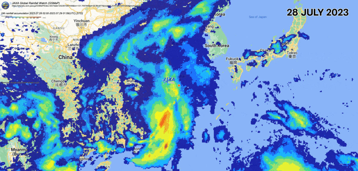 Figure 5: Skies around Fujian province and eastern regions are clear from 1 August. Source: JAXA Global Rainfall Watch
Are you living in these regions? If so, we’re hoping to get more first-hand eye witness accounts. Please reach us via email. Follow us on Twitter @Kyrios_Earth and Facebook @KyriosEarthHealerEn for updates.
Data sources: Philippine Atmospheric, Geophysical and Astronomical Services Administration (PAGASA), Zoom Earth, JAXA Global Rainfall Watch
About Kyrios’ climate interventions
Kyrios’ climate interventions across key areas on Earth aims to reduce impact of disasters on local communities through deliberate weather modifications, healing Earth’s systems and providing us time to move towards a more sustainable future. This complements existing mitigation and adaptation measures. Kyrios also intervenes in climate disasters to reduce their destructive impacts on affected communities.
For more information on Kyrios’ climate crisis interventions, please go here. If you have questions, feel free to ask them here.


